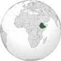
Faylo:Ethiopia (Africa orthographic projection).svg

此 SVG 檔案的 PNG 預覽的大小:550 × 550 ko kasapinang no siyang-su。 o romaay a cyi-si-tu: 240 × 240 ko kasapinang no siyang-su | 480 × 480 ko kasapinang no siyang-su | 768 × 768 ko kasapinang no siyang-su | 1,024 × 1,024 ko kasapinang no siyang-su | 2,048 × 2,048 ko kasapinang no siyang-su.
satapangan tang’an (SVG tang^an,tata’ak no laleko:550 × 550 syang-su no sya-sing, o tata’ak no tang^an:143 KB)
o likisi no tang’an
pili’en a mimi^mi ko romi’ad/ tok, ta misongila’ a minengneng to tang’an rorong nora tatokian
| O romi’ad/ toki | nisamamangan a conga | o tata’ak ato karaya’ | micokaymasay | pipatongalan to sowal | |
|---|---|---|---|---|---|
| Aniniay/imatinaay | 2012年8月30日 (四) 17:42 |  | 550 × 550(143 KB) | Sémhur | Same with shadow |
| 2012年8月30日 (四) 17:40 |  | 550 × 550(143 KB) | Sémhur | Correcting few mistakes | |
| 2011年7月15日 (五) 18:28 |  | 550 × 550(134 KB) | Mixx321 | Sudan Południowy | |
| 2009年12月27日 (日) 19:34 |  | 550 × 550(132 KB) | Sémhur | == {{int:filedesc}} == {{Information |Description={{en|1=Orthographic map of Africa, showing Ethiopia location.}} {{fr|1=Carte orthographique de l'Afrique, montrant l'emplacement de l'Éthiopie.}} |Source=*[[:File:Africa |
sakatayal no tang’an
Awaay ko felih to sapakakafit tonini a tang^an.
O laleko no tang^an i po:long no micokaymas
i kalaenoay oya no roma a wiki micokaymas tonini a tang^an :
- O demak to picokaymas no ady.wikipedia.org
- O demak to picokaymas no am.wikipedia.org
- O demak to picokaymas no am.wiktionary.org
- O demak to picokaymas no ang.wikipedia.org
- O demak to picokaymas no arc.wikipedia.org
- O demak to picokaymas no ar.wikipedia.org
- O demak to picokaymas no ar.wiktionary.org
- O demak to picokaymas no arz.wikipedia.org
- O demak to picokaymas no avk.wikipedia.org
- O demak to picokaymas no azb.wikipedia.org
- O demak to picokaymas no az.wiktionary.org
- O demak to picokaymas no ban.wikipedia.org
- O demak to picokaymas no bbc.wikipedia.org
- O demak to picokaymas no be-tarask.wikipedia.org
- O demak to picokaymas no be.wikipedia.org
- O demak to picokaymas no bg.wikipedia.org
- O demak to picokaymas no bh.wikipedia.org
- O demak to picokaymas no bi.wikipedia.org
- O demak to picokaymas no bm.wikipedia.org
- O demak to picokaymas no bxr.wikipedia.org
- O demak to picokaymas no cdo.wikipedia.org
- O demak to picokaymas no ceb.wikipedia.org
- O demak to picokaymas no chr.wikipedia.org
- O demak to picokaymas no ckb.wikipedia.org
- O demak to picokaymas no cs.wikipedia.org
- O demak to picokaymas no cu.wikipedia.org
- O demak to picokaymas no dag.wikipedia.org
- O demak to picokaymas no da.wikipedia.org
- O demak to picokaymas no de.wikivoyage.org
- O demak to picokaymas no din.wikipedia.org
- O demak to picokaymas no el.wikipedia.org
- O demak to picokaymas no en.wikipedia.org
- Rastafari
- Ethiopia
- List of companies of Ethiopia
- LGBT rights in Ethiopia
- History of the Jews in Ethiopia
- List of conflicts in Ethiopia
- User:Pharaoh Amun
- Wikipedia talk:Manual of Style/Pronunciation/Archive 9
- User:PMK2000/sandbox/Ethiopia
- User:JosephMohan/sandbox
- Wikipedia:Wikipedia Signpost/2019-10-31/On the bright side
- Wikipedia:Wikipedia Signpost/Single/2019-10-31
- User:BushelCandle/Ethiopia - stable lede
- User:BushelCandle/Template:Ethiopia
- 2023 Ethiopian crackdown on the hospitality industry
- Portal:Ethiopia
- Portal:Ethiopia/Intro
misongila’ a minengneng tona matongal ko hekal to picokaymas no tang’an
