
Faylo:Azerbaijan (orthographic projection).svg

此 SVG 檔案的 PNG 預覽的大小:551 × 551 ko kasapinang no siyang-su。 o romaay a cyi-si-tu: 240 × 240 ko kasapinang no siyang-su | 480 × 480 ko kasapinang no siyang-su | 768 × 768 ko kasapinang no siyang-su | 1,024 × 1,024 ko kasapinang no siyang-su | 2,048 × 2,048 ko kasapinang no siyang-su.
satapangan tang’an (SVG tang^an,tata’ak no laleko:551 × 551 syang-su no sya-sing, o tata’ak no tang^an:570 KB)
o nisa’amotoan a pakimad
| kimad |
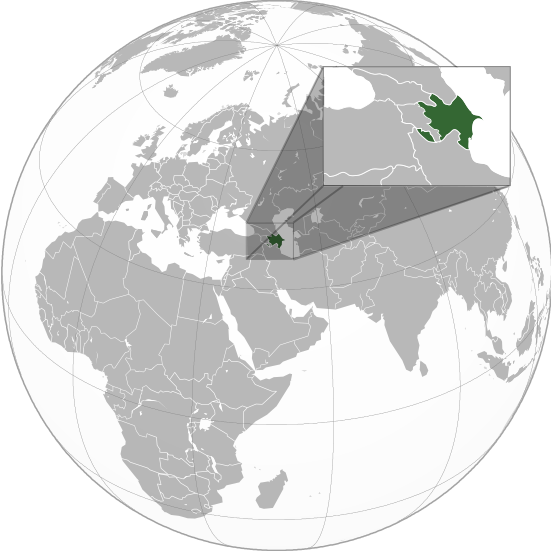
English: Orthographic Projection Map of Azerbaijan.
The other orthographic projection maps. .svg) |
| O romi’ad | |
| lalengatan | O no tireng a nakamayan a misorit |
| O misoritay | en:User:Night w |
.svg)
.svg)
.svg)
.svg)
.svg)
.svg)
.svg)
.svg)
.svg)
.svg)
.svg)
.svg)
.svg)
.svg)
.svg)
.svg)
.svg)
.svg)
.svg)
.svg)
.svg)
.svg)
.svg)
.svg)
.svg)
.svg)
.svg)
.svg)
.svg)
.svg)
.svg)
.svg)
.svg)
.svg)
.svg)
.svg)
.svg)
.svg)
.svg)
.svg)
.svg)
.svg)
.svg)
.svg)
.svg)
.svg)
.svg)
.svg)
.svg)
.svg)
.svg)
.svg)
.svg)
.svg)
.svg)
.svg)
.svg)
.svg)
.svg)
.svg)
.svg)
.svg)
.svg)
.svg)
.svg)
.svg)
.svg)
.svg)
.svg)
.svg)
.svg)
.svg)
.svg)

.svg)

.svg)

.svg)
.svg)
.svg)
.svg)
.svg)
.svg)
.svg)


.svg)
.svg)
.svg)
.svg)
.svg)
.svg)
.svg)

.svg)
.svg)
.svg)
.svg)
.svg)
.svg)
.svg)
.svg)
.svg)
.svg)

.svg)
.svg)
.svg)
.svg)
.svg)
.svg)
.svg)
_without_national_boundaries.svg)
.svg)
.svg)
.svg)
.svg)
.svg)
.svg)

.svg)
.svg)
.png)
.svg)
.svg)
.svg)
.svg)

.svg)
.svg)
.svg)
.svg)
.svg)
.svg)
.svg)
.svg)
.svg)
.svg)
.svg)

.svg)
.svg)
.svg)
.svg)
.svg)
.svg)
.svg)
.svg)
.svg)

.svg)
.svg)

.svg)
.svg)
.svg)
.svg)
.svg)
.svg)
.svg)
.svg)
.svg)
.svg)
.svg)
.svg)
.svg)
.svg)
.svg)
.svg)
.svg)
.svg)
.svg)
.svg)
.svg)
.svg)
.svg)
.svg)
.svg)
.svg)
.svg)
_-_Crimea_disputed.svg)
.svg)
.svg)
.svg)
.svg)
.svg)
.svg)
.svg)
.svg)
.svg)
.svg)
.svg)
_political.svg)
.svg)
.svg)
.svg)
.svg)
_-_Crimea_disputed_-_no_borders.svg)
.svg)
.svg)
.svg)
.svg)
.svg)
.svg)
.svg)
.svg)
.svg)
.svg)
.svg)

.svg)
.svg)
.svg)

.png)
.svg)
.svg)
.svg)
.svg)
.svg)
.svg)
.svg)
.svg)
.svg)
.svg)
.svg)
.svg)
.svg)
.svg)
.svg)
.svg)
.svg)
.svg)
.svg)
.svg)
.svg)
.svg)
.svg)
.svg)
.svg)
.svg)
.svg)
.svg)
.svg)
.svg)
.svg)
.svg)
.svg)
.svg)
.png)
.svg)
.svg)
.svg)
_(orthographic_projection).png)
.svg)
o sakipatorod a tilid
我,本作品的著作權持有者,決定用以下授權條款發佈本作品:

|
Mapatorodto kiso, mido^do^ tonini a pakoniraay a ruan-ti ci-cing-hweyawaayay ko mi’er’eray a codad to mipasadakan, i ka’ayaw ato i kalaeno no codad, GNU pakoniraay a codad to nipatorodan i saka 1.2 rorongano eca o pakoniraay i rarikoray a rorong, a mi-ko-pi to tang^an, mipasadak imitiya, ano eca misalof. Oya mi-ko-pi-an a kiyak i, ira matili^ i GNU pakonira sanay a codad no nipatorodan a tilid. |
Nani tiniay i misatapang micokaymas CC konini a tang^an a macokaymas mapasapinang ko ngangan- malecaday pidemak a palada’ 3.0 caay ko no sanoitiniay a demak ko matiliday a rorong o sapipatorod a lawot.
- manga’ay pakonirasa kiso a:
- Mipalada’ – rorod、 patalahekal ato patenak to ninian a nisanga’an
- liyawen a misalof – o nisasaharatengan a nisanga’an
- aka ca piso^do tora ilaenoay a sakarocek:
- Sakacipinang a pangangan – aka ca pido^do^ kiso to nitooran no misoritay ano eca o mihaydaay to sakacipinang a ngangan nikaorira, aka pitakaw a pakafana’ to picokaymas no miso to
- malecaday pidemak palada’ – Ano inian a nisoritan ko sapisomad, sapifalic, ato sapisafaeloh iso a misorit i, onini a rikec ano eca oya malecaday a rikec ko sapicokaymas iso a micowat misanga’ to roma a sorit.[1]
manga’ay mipili’ kiso to kanikawan iso a tilid to sakipatorod
原始上傳日誌
The original description page was on en.wikipedia (file log). All following user names refer to en.wikipedia.
.svg)
- 23:49, 20 April 2011 (UTC) Sisyphos23 551×551 (557 KB)
- 14:15, 15 April 2011 (UTC) Chipmunkdavis 551×551 (568 KB) (Sharpening smaller image)
- 09:57, 15 April 2011 (UTC) Dbachmann 551×551 (577 KB) (suggestion)
- 23:05, 14 April 2011 (UTC) Night w 551×551 (571 KB) (trying to colour)
- 22:58, 14 April 2011 (UTC) Night w 551×551 (575 KB) ({{Information |Description={{en|1=Azerbaijan}} |Source=Own work |Author=Night w |Date=2011-04 |Permission= |other_versions={{User:Ssolbergj/orthographic}} }} == {{int:license}} == {{self|cc-by-sa-3.0|GFDL|migration=redundant}} {{ImageNot)
o likisi no tang’an
pili’en a mimi^mi ko romi’ad/ tok, ta misongila’ a minengneng to tang’an rorong nora tatokian
.svg&dir=prev)
.svg&offset=20160827021508)
.svg&offset=&limit=20)
.svg&offset=&limit=50)
.svg&offset=&limit=100)
.svg&offset=&limit=250)
.svg&offset=&limit=500)
| O romi’ad/ toki | nisamamangan a conga | o tata’ak ato karaya’ | micokaymasay | pipatongalan to sowal | |
|---|---|---|---|---|---|
| Aniniay/imatinaay | 2023年3月23日 (四) 09:36 | | 551 × 551(570 KB) | M.Bitton | Reverted to version as of 09:05, 14 September 2022 (UTC): per COM:OVERWRITE |
| 2023年3月22日 (tinolo) 21:56 |  | 689 × 689(445 KB) | Multituberculata | ||
| 2022年9月17日 (六) 07:29 |  | 551 × 551(570 KB) | M.Bitton | Reverted to version as of 09:05, 14 September 2022 (UTC): per COM:OVERWRITE | |
| 2022年9月17日 (六) 05:54 |  | 689 × 689(445 KB) | Hogweard | Issues fixed - and South Sudan border added | |
| 2022年9月14日 (tinolo) 17:05 |  | 551 × 551(570 KB) | Toghrul R | Reverted to version as of 15:45, 29 August 2016 (UTC) the Middle East region and Europe were broken, reverting to the previous version without South Sudan; waiting for the fix | |
| 2019年12月14日 (六) 02:00 |  | 551 × 551(421 KB) | Goran tek-en | Added border for South Sudan as requested by {{u|Maphobbyist}} | |
| 2016年8月29日 (tinocay) 23:45 |  | 551 × 551(570 KB) | Artoxx | Reverted to version as of 15:31, 19 April 2016 (UTC) | |
| 2016年8月29日 (tinocay) 23:44 |  | 551 × 551(190 KB) | Artoxx | Reverted to version as of 02:15, 27 August 2016 (UTC) | |
| 2016年8月27日 (六) 10:16 |  | 551 × 551(190 KB) | MosMusy | Georgia and Moldova have their main maps with territories not under control shaded. | |
| 2016年8月27日 (六) 10:15 |  | 551 × 551(190 KB) | MosMusy | Moldova and Georgia's map all have shading for territory not under their government's control. |
sakatayal no tang’an
Onini laenoay makakafit ko felihtayi tonini a tang^an:
O laleko no tang^an i po:long no micokaymas
i kalaenoay oya no roma a wiki micokaymas tonini a tang^an :
- O demak to picokaymas no af.wikipedia.org
- O demak to picokaymas no arc.wikipedia.org
- O demak to picokaymas no ar.wikipedia.org
- قائمة الدول ذات السيادة والأقاليم التابعة في آسيا
- مستخدم:جار الله/قائمة صور مقالات العلاقات الثنائية
- العلاقات الأذربيجانية الأمريكية
- العلاقات الأذربيجانية الأنغولية
- العلاقات الأذربيجانية الكورية الجنوبية
- العلاقات الأذربيجانية الإريترية
- العلاقات الأذربيجانية السويسرية
- العلاقات الأذربيجانية الألمانية
- العلاقات الأذربيجانية الليختنشتانية
- العلاقات الأذربيجانية البوليفية
- العلاقات الأذربيجانية الموزمبيقية
- العلاقات الأذربيجانية الألبانية
- العلاقات الأذربيجانية البلجيكية
- العلاقات الأذربيجانية الإثيوبية
- العلاقات الأذربيجانية البيلاروسية
- العلاقات الأذربيجانية الطاجيكستانية
- العلاقات الأذربيجانية الرومانية
- العلاقات الأذربيجانية الأرجنتينية
- العلاقات الأذربيجانية الغامبية
- العلاقات الأذربيجانية القبرصية
- العلاقات الأذربيجانية السيراليونية
- العلاقات الأذربيجانية النيبالية
- العلاقات الأذربيجانية الليبيرية
- العلاقات الأذربيجانية التشيكية
- العلاقات الأذربيجانية الميانمارية
- العلاقات الأذربيجانية الكندية
- العلاقات الأذربيجانية الزيمبابوية
- العلاقات الأذربيجانية البالاوية
- العلاقات الأذربيجانية النيجيرية
- العلاقات الأذربيجانية اليمنية
- العلاقات الأذربيجانية الفانواتية
- العلاقات الأذربيجانية الغابونية
- العلاقات الأذربيجانية البنمية
- العلاقات الأذربيجانية الكوبية
- العلاقات الأذربيجانية الجورجية
- العلاقات الأذربيجانية التونسية
- العلاقات الأذربيجانية الكورية الشمالية
- العلاقات الأذربيجانية الهندية
- العلاقات الأذربيجانية اليابانية
- العلاقات الأذربيجانية الإيطالية
- العلاقات الأذربيجانية الناوروية
- العلاقات الأذربيجانية الأسترالية
- العلاقات الأذربيجانية الزامبية
- العلاقات الأذربيجانية الفيجية
- العلاقات الأذربيجانية المارشالية
- العلاقات الأذربيجانية المالية
- العلاقات الأذربيجانية السودانية
misongila’ a minengneng tona matongal ko hekal to picokaymas no tang’an
.svg)
.svg)