
Faylo:Santa Catalina Arch - Antigua Guatemala Feb 2020.jpg

satapangan tang’an (6,993 × 4,664 ko kasapinang no siyang-su, o tata’ang no pinaro:33.58 MB,MIME kassiroma a:image/jpeg)
o nisa’amotoan a pakimad
| kimad |
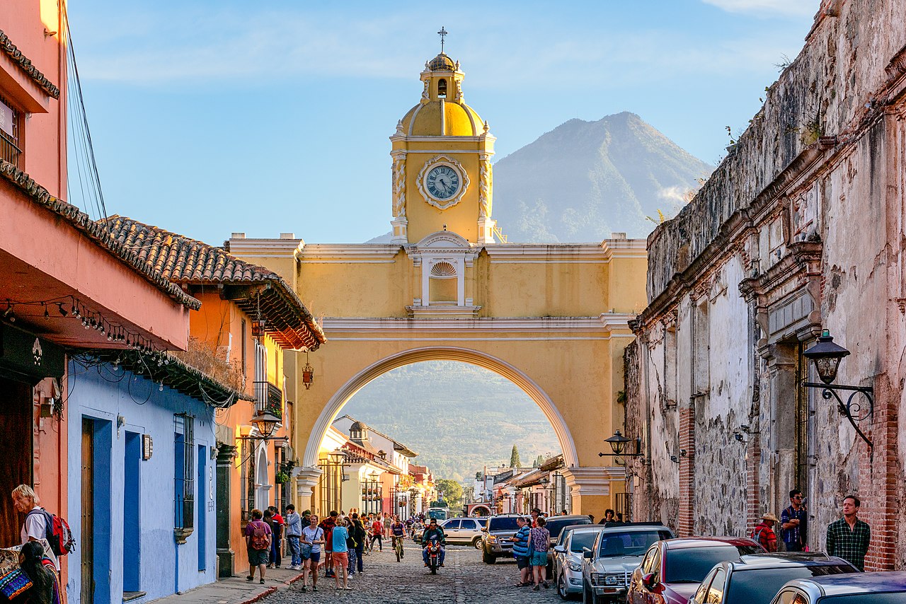
English: The Santa Catalina Arch is one of the distinguishable landmarks in Antigua Guatemala, Guatemala, located on 5th Avenue North. Built in the 17th century, it originally connected the Santa Catalina convent to a school, allowing the cloistered nuns to pass from one building to the other without going out on the street. A clock on top was added in the era of the Central American Federation, in the 1830s. Source: en.wikipedia.org/wiki/Arco_de_Santa_Catalina
In the background is Volcán de Agua (also known as Hunahpú by Maya) is a stratovolcano located in the departments of Sacatepéquez and Escuintla in Guatemala. At 3,760 m (12,340 ft), Agua Volcano towers more than 3,500 m (11,500 ft) above the Pacific coastal plain to the south and 2,000 m (6,600 ft) above the Guatemalan Highlands to the north. It dominates the local landscape except when hidden by cloud cover. The volcano is within 5 to 10 km (3.1 to 6.2 mi) of the city of Antigua Guatemala and several other large towns situated on its northern apron. These towns have a combined population of nearly 100,000. It is within about 20 km of Escuintla (population, ca. 150,000) to the south. Source: en.wikipedia.org/wiki/Volc%C3%A1n_de_Agua |
| O romi’ad | |
| lalengatan | https://www.flickr.com/photos/146321178@N05/49640785242/ |
| O misoritay | Chad Davis |
| 其他版本 |
| 拍攝地點 | | 位於此地的本圖片與其他圖片: OpenStreetMap |
|---|
o sakipatorod a tilid
- manga’ay pakonirasa kiso a:
- Mipalada’ – rorod、 patalahekal ato patenak to ninian a nisanga’an
- liyawen a misalof – o nisasaharatengan a nisanga’an
- aka ca piso^do tora ilaenoay a sakarocek:
- Sakacipinang a pangangan – aka ca pido^do^ kiso to nitooran no misoritay ano eca o mihaydaay to sakacipinang a ngangan nikaorira, aka pitakaw a pakafana’ to picokaymas no miso to
- malecaday pidemak palada’ – Ano inian a nisoritan ko sapisomad, sapifalic, ato sapisafaeloh iso a misorit i, onini a rikec ano eca oya malecaday a rikec ko sapicokaymas iso a micowat misanga’ to roma a sorit.[1]
| 這幅圖片原始出處為Flickr的https://flickr.com/photos/146321178@N05/49640785242 ,作者為chaddavis.photography 。經機器人FlickreviewR 2在2020年Saka tolo^ folad16日審查後確定為採用cc-by-sa-2.0的協議授權使用。 |
o likisi no tang’an
pili’en a mimi^mi ko romi’ad/ tok, ta misongila’ a minengneng to tang’an rorong nora tatokian
| O romi’ad/ toki | nisamamangan a conga | o tata’ak ato karaya’ | micokaymasay | pipatongalan to sowal | |
|---|---|---|---|---|---|
| Aniniay/imatinaay | 2020年3月13日 (五) 10:56 | | 6,993 × 4,664(33.58 MB) | Infrogmation | Uploaded a work by Chad Davis from https://www.flickr.com/photos/146321178@N05/49640785242/ with UploadWizard |
sakatayal no tang’an
Onini laenoay makakafit ko felihtayi tonini a tang^an:
O laleko no tang^an i po:long no micokaymas
i kalaenoay oya no roma a wiki micokaymas tonini a tang^an :
- O demak to picokaymas no ar.wikipedia.org
- O demak to picokaymas no arz.wikipedia.org
- O demak to picokaymas no ast.wikipedia.org
- O demak to picokaymas no ba.wikipedia.org
- O demak to picokaymas no ceb.wikipedia.org
- O demak to picokaymas no cs.wikipedia.org
- O demak to picokaymas no de.wikivoyage.org
- O demak to picokaymas no el.wikipedia.org
- O demak to picokaymas no en.wikipedia.org
- O demak to picokaymas no en.wikivoyage.org
- O demak to picokaymas no eo.wikipedia.org
- O demak to picokaymas no es.wikipedia.org
- O demak to picokaymas no eu.wikipedia.org
- O demak to picokaymas no fr.wikivoyage.org
- O demak to picokaymas no gl.wikipedia.org
- O demak to picokaymas no he.wikivoyage.org
- O demak to picokaymas no hr.wikipedia.org
- O demak to picokaymas no hy.wikipedia.org
- O demak to picokaymas no id.wikipedia.org
- O demak to picokaymas no it.wikipedia.org
- O demak to picokaymas no it.wikivoyage.org
- O demak to picokaymas no ja.wikipedia.org
- O demak to picokaymas no ja.wikivoyage.org
- O demak to picokaymas no mt.wikipedia.org
- O demak to picokaymas no pl.wikipedia.org
- O demak to picokaymas no pt.wikipedia.org
- O demak to picokaymas no ro.wikipedia.org
- O demak to picokaymas no ru.wikipedia.org
- O demak to picokaymas no sl.wikipedia.org
- O demak to picokaymas no sr.wikipedia.org
- O demak to picokaymas no th.wikipedia.org
- O demak to picokaymas no www.wikidata.org
- O demak to picokaymas no zh.wikipedia.org