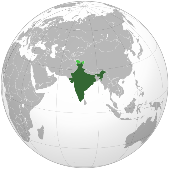
Faylo:India (orthographic projection).svg

此 SVG 檔案的 PNG 預覽的大小:541 × 541 ko kasapinang no siyang-su。 o romaay a cyi-si-tu: 240 × 240 ko kasapinang no siyang-su | 480 × 480 ko kasapinang no siyang-su | 768 × 768 ko kasapinang no siyang-su | 1,024 × 1,024 ko kasapinang no siyang-su | 2,048 × 2,048 ko kasapinang no siyang-su.
satapangan tang’an (SVG tang^an,tata’ak no laleko:541 × 541 syang-su no sya-sing, o tata’ak no tang^an:280 KB)
o likisi no tang’an
pili’en a mimi^mi ko romi’ad/ tok, ta misongila’ a minengneng to tang’an rorong nora tatokian
| O romi’ad/ toki | nisamamangan a conga | o tata’ak ato karaya’ | micokaymasay | pipatongalan to sowal | |
|---|---|---|---|---|---|
| Aniniay/imatinaay | 2023年4月26日 (tinolo) 15:10 |  | 541 × 541(280 KB) | Swtadi143 | Reverted to version as of 07:34, 16 September 2021 (UTC) siachen glacier is fully controlled by india and not india pakistan jointly, see Siachen conflict for context. |
| 2021年9月20日 (tinocay) 18:02 |  | 512 × 512(155 KB) | Ytpks896 | Reverted to version as of 17:38, 6 September 2021 (UTC) Siachen is a disputed territory not fully controlled by single country it is controlled by both Pakistan and india & some parts by china | |
| 2021年9月16日 (四) 15:34 |  | 541 × 541(280 KB) | Ksh.andronexus | Reverted to version as of 16:08, 19 December 2019 (UTC) | |
| 2021年9月7日 (tinosa) 01:38 |  | 512 × 512(155 KB) | Milenioscuro | Siachen is a disputed territory between China, India and Pakistan | |
| 2019年12月20日 (五) 00:08 |  | 541 × 541(280 KB) | Goran tek-en | Added border for South Sudan as requested by {{u|Maphobbyist}} | |
| 2017年10月21日 (六) 22:04 |  | 541 × 541(139 KB) | Goran tek-en | Added Siachen Glacier as requested by {{u|King Prithviraj II}} | |
| 2012年9月13日 (四) 05:31 |  | 541 × 541(167 KB) | Palosirkka | Scrubbed with http://codedread.com/scour/ | |
| 2009年11月16日 (tinocay) 07:40 |  | 541 × 541(573 KB) | Shibo77 | +Eritrea, Yemen; -neutral zone | |
| 2009年11月1日 (日) 21:18 |  | 541 × 541(496 KB) | Pahari Sahib | Map showing territory governered by India, see map of Pakistan | |
| 2009年3月11日 (tinolo) 21:17 |  | 541 × 541(572 KB) | Tryphon | Reverted to version as of 22:12, 13 February 2009: please use the talk page before reverting this image; there are apparently many people who want the map this way. |
sakatayal no tang’an
Onini laenoay makakafit ko felihtayi tonini a tang^an:
O laleko no tang^an i po:long no micokaymas
i kalaenoay oya no roma a wiki micokaymas tonini a tang^an :
- O demak to picokaymas no ace.wikipedia.org
- O demak to picokaymas no ady.wikipedia.org
- O demak to picokaymas no af.wikipedia.org
- O demak to picokaymas no am.wikipedia.org
- O demak to picokaymas no anp.wikipedia.org
- O demak to picokaymas no an.wikipedia.org
- O demak to picokaymas no arc.wikipedia.org
- O demak to picokaymas no ar.wikipedia.org
- O demak to picokaymas no ar.wiktionary.org
- O demak to picokaymas no arz.wikipedia.org
- O demak to picokaymas no ast.wikipedia.org
- O demak to picokaymas no as.wikipedia.org
- O demak to picokaymas no atj.wikipedia.org
- O demak to picokaymas no avk.wikipedia.org
- O demak to picokaymas no av.wikipedia.org
- O demak to picokaymas no awa.wikipedia.org
- O demak to picokaymas no azb.wikipedia.org
- O demak to picokaymas no az.wikipedia.org
- O demak to picokaymas no az.wiktionary.org
- O demak to picokaymas no ban.wikipedia.org
- O demak to picokaymas no bat-smg.wikipedia.org
- O demak to picokaymas no ba.wikipedia.org
- O demak to picokaymas no bbc.wikipedia.org
- O demak to picokaymas no bcl.wikipedia.org
- O demak to picokaymas no be-tarask.wikipedia.org
- O demak to picokaymas no beta.wikiversity.org
- O demak to picokaymas no be.wikipedia.org
- O demak to picokaymas no bg.wikipedia.org
- O demak to picokaymas no bh.wikipedia.org
- O demak to picokaymas no bi.wikipedia.org
- O demak to picokaymas no bjn.wikipedia.org
- O demak to picokaymas no blk.wikipedia.org
misongila’ a minengneng tona matongal ko hekal to picokaymas no tang’an


